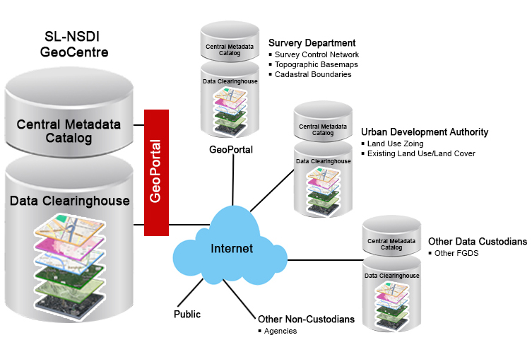
With the aim of improving the use of spatial data and promote SMART and spatial based decision making, the Government of Sri Lanka implemented a National Spatial Data Infrastructure (NSDI) program. NSDI has been identified as one of the key initiatives under the National Digital Policy - “Digitalization of the Economy” by the Government of Sri Lanka.
Since its inception in 2016, the primary focus of NSDI is to create world-class infrastructure and solutions that will enable spatial data standardization, avoid data duplication, improve data quality, improve transparency in data sharing across departments and provide a technology platform for developing spatial data decision support tools. NSDI creates an ecosystem where government and private sector organizations can collaborate to manage, improve and exchange spatial data and information.
Complying with the international standards like ISO and Open Geospatial Consortium guidelines, NSDI continues to institutionalize data sharing, standards, formats, policies, data creation and update process across the Government of Sri Lanka.
The functions of the NSDI Office are to be carried out by a number of interdependent teams.